ÅåÆ«èÓ unmanned aircraft joins Funny River firefighting efforts
May 30, 2014

Diana Campbell
907-322-7686
5/30/2014
An unmanned aircraft from ÅåÆ«èÓ is assisting firefighting efforts in the Funny River Fire near Kenai, Alaska.
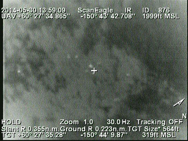
Early Friday morning, a team from the university's Alaska Center for Unmanned Aircraft Systems Integration flew a ScanEagle aircraft over the fire. The aircraft, equipped with infrared image sensors and cameras, found about 15 hot spots within the fire perimeter.
ãIt was invaluable because it can fly at night to look for hot spots in the cooler evening hours,ã said Celeste Prescott, public information officer with Alaska Interagency Incident Management Team. ãThe only other aircraft that could do that, which would be manned, would have to come from the Lower 48.ã
The ScanEagle was also able to map the fire boundaries more accurately because it can fly at a lower altitude than manned aircraft, Prescott said. The aircraft is scheduled to fly again Friday evening. Operations are based on a private airstrip on Funny River Road.
ãWe are happy with our first flight's results, which identified some hot spots in locations the incident command asked us to check,ã said Marty Rogers, ACUASI director and mission director. ãAfter making improvements to our antenna today, we will be able to observe a larger set of objectives during future flights. We are very pleased to be able to respond to the Division of Forestryãs callout to us and assist with the mission here.ã
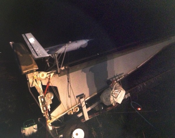
ã´The ScanEagle, which is launched via catapult and landed with a catch wire, will also be used to identify threats to people and structures, as well as identify more hot spots and fire boundaries from an altitude of 1,200 to 2,500 feet. Infrared sensors are able to see through dense smoke easily and unmanned aircraft is usually less expensive to operate than manned aircraft.

The Funny River Fire started May 19 and has rapidly grown to over 193,000 acres with 759 personnel working the wildfire. The fire was 46 percent contained as of Friday morning.
The ACUASI team worked closely with the interagency fire team and the Federal Aviation Administration to set up mission guidelines before introducing ScanEagle operations to the firefighting efforts, said Ro Bailey, ACUASI deputy director.
ãI expect that a significant benefit from this real-world mission will be the procedures developed by FAA for air traffic control and the data gathered on how well those procedures work to protect aviation safety while enhancing the safety and effectiveness of the firefighting operations.
ACUASI, part of the ÅåÆ«èÓ Geophysical Institute, has participated in previous wildfire fighting efforts. In 2012, the ScanEagle and the Aeryon Scout used infrared imagers, cameras and an aerosol mass concentration sensor to gather data as part of a Combustion and Atmospheric Dynamics Research Experiment, led by the U.S. Forest Service. In 2009, ACUASI used the ScanEagle to map the Crazy Mountain Complex Fire near Central, Alaska.
ADDITIONAL CONTACTS: Ro Bailey, ACUASI, 907-474-2015 or 907-322-2255. Celeste Prescott, AKINT, 907-714-2484.
ON THE WEB: or
DC/5-30-14/335-14


